
Air pollution is not just a haze above a city. It can vary sharply between a roadside, an industrial fence line, and the rooftops nearby. The World Health Organization reported that 99% of the global population breathed air exceeding its 2021 guideline levels in 2019. Its 2022 air pollution fact sheet also estimated 4.2 million premature deaths from ambient air pollution that year. These figures explain why timely, location-specific measurements matter.
Air Pollution Detection Drones can carry sensors to sample pollutants at different heights and across hard-to-reach areas. They may help identify short-lived hotspots that fixed monitors miss. But a drone is not a reference laboratory. Results depend on sensor quality, calibration, flight path, weather, and the aircraft’s own airflow. Small details matter. A drifting reading can change what a map appears to show.
For buyers in 2026, the right choice depends on the monitoring task, not just advertised range or flight time. Compare supported pollutants, detection limits, calibration procedures, payload capacity, data handling, and service support. Check whether the supplier provides test methods and validation evidence, not only polished dashboards. The State of Global Air 2024 report, produced by the Health Effects Institute and UNICEF, estimated 8.1 million deaths linked to air pollution worldwide in 2021. That broader burden makes dependable measurements valuable, but drones alone cannot solve it. This guide examines leading options and the practical trade-offs behind them. Some specifications still need careful verification.
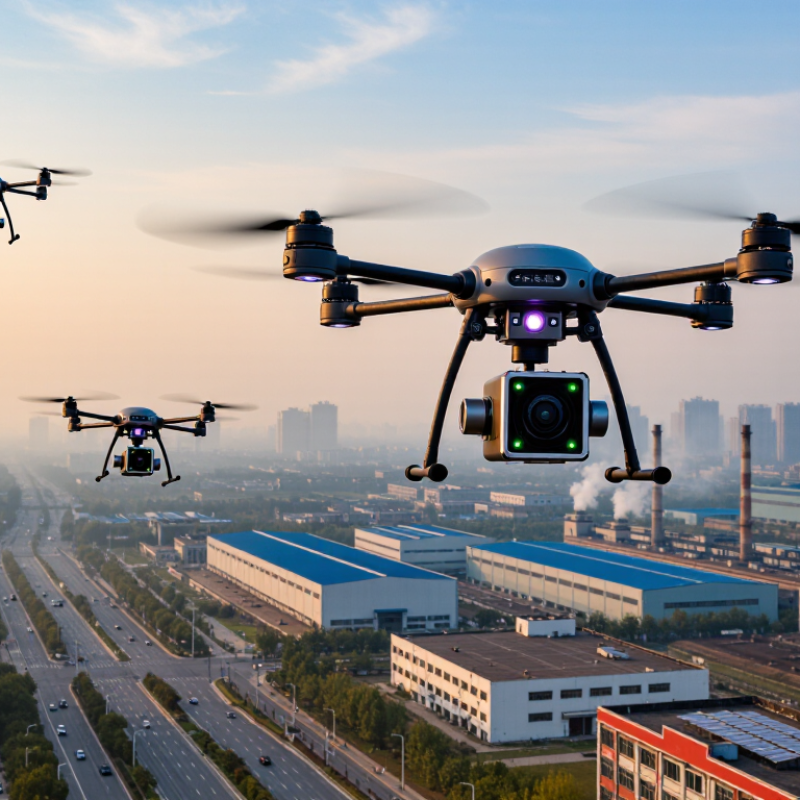
Air pollution detection drones measure gases and particles where fixed stations may miss short-lived changes. Depending on their sensors, they can record fine particulate matter, ozone, nitrogen dioxide, sulfur dioxide, or carbon monoxide. Some also track temperature, humidity, pressure, and wind. These details help explain why readings rise or fall. A particle sensor, for example, may respond differently in damp air.
The value is spatial detail. A drone can sample at several heights above a road, near a worksite, or downwind of an industrial area. A map of readings may reveal a narrow plume that a roadside monitor averages away. That matters. But a drone reading is not automatically a complete picture of exposure. Flight speed, sensor response time, and sampling height can all affect results.
Reliable use depends on careful checks. Teams should calibrate sensors, record weather, and compare airborne readings with trusted ground measurements when possible. One flight is not a verdict. Repeated routes under different conditions give stronger evidence, though they still leave gaps. I would be cautious about treating a colorful map as proof of a pollution source; it shows measured patterns, not necessarily their cause.
2026 Top Air Pollution Detection Drones for Buyers
Key Sensors and Sampling Methods Used by Detection Drones
A useful drone payload starts with the pollutant question, not the flight plan. Optical particle counters estimate PM1, PM2.5, and PM10 from laser-scattered light. Electrochemical sensors can track gases such as nitrogen dioxide, sulfur dioxide, and carbon monoxide. For volatile organic compounds, a photoionization detector gives a broad reading, not a reliable chemical identity. That distinction matters.
Sampling design changes what the readings mean. Onboard sensors provide continuous measurements, while filter samplers collect particles for later laboratory analysis. Sorbent tubes can capture selected gases or vapors. In either setup, record altitude, time, humidity, and wind alongside each sample. Rotor wash may disturb a plume near the drone. Small details matter.
The U.S. EPA’s 2022 Enhanced Air Sensor Guidebook recommends comparing sensor readings with reference-grade monitors, since low-cost sensors can be affected by weather and other pollutants. The WHO’s 2021 air quality guidelines set annual PM2.5 at 5 μg/m³ and the 24-hour level at 15 μg/m³. These are health-based benchmarks, not guarantees that a compact drone sensor can meet that precision. Useful, but incomplete. Calibration, inlet placement, and repeat flights can make results more dependable; even then, a tidy map may conceal uneven sampling.
A useful air pollution drone should be judged by the measurements it can defend, not by its flight range alone. Check which pollutants its sensors detect, such as particulate matter, ozone, or nitrogen dioxide. Ask for accuracy ranges, detection limits, and calibration procedures. A sensor reading is not automatically reliable. Temperature and humidity can affect some measurements, while propeller airflow may disturb sampling. Look for a documented inlet position and clear notes about operating conditions.
Field readiness matters. Compare flight time with the full sensor payload installed, not an empty-aircraft specification. Consider whether the drone can hold a steady route and record location, altitude, and time beside every sample. Good data systems make later review easier. Calibration against a suitable reference instrument before and after fieldwork can reveal drift. That detail is easy to miss.
Buyers should also examine how results are presented. Useful software should flag gaps, sensor faults, and unusual readings rather than smoothing them away. Ask whether raw data can be exported for independent analysis. A polished map may hide uncertainty. Review training needs, battery handling, maintenance intervals, and support for replacing or recalibrating sensors. The best choice depends on the intended site: a roadside survey, for example, needs different coverage and sampling plans than monitoring around an industrial perimeter. No specification sheet can settle every question; a short, controlled trial often exposes practical weaknesses.
Use these PM2.5 benchmarks to assess whether a drone’s sensor can reliably detect concentrations relevant to public-health guidance and regulation. When comparing systems, also evaluate calibration and quality assurance, measurement range and resolution, payload capacity, flight endurance, GPS and timestamp accuracy, and the ability to sample at different heights. The chart shows air-quality benchmarks, not drone performance ratings.
Sources: WHO Global Air Quality Guidelines (2021); U.S. EPA National Ambient Air Quality Standards for PM2.5 (annual standard revised in 2024). Values are in µg/m³.
Multirotor drones suit close-range checks around factories, road corridors, and landfill edges. They can hover beside a stack or follow a short route, giving operators time to compare readings at several heights. Choose payloads based on the target: optical particle sensors for particulate matter, or gas-specific instruments for pollutants such as ozone and nitrogen dioxide. Payload weight and rotor wash can affect measurements. That detail is easy to underestimate.
Fixed-wing drones cover broader areas more efficiently. They fit regional surveys over farms, wildfire-affected land, or large industrial zones, where long transects matter more than hovering. The World Health Organization’s 2021 air quality guidelines set the annual PM2.5 guideline at 5 µg/m³, half the previous level. At these low concentrations, buyers should check instrument detection limits and calibration records, not just advertised flight range.
Tethered multirotors can support longer observations at a site, such as tracking changing conditions near a construction boundary. They offer less coverage and need a safe, unobstructed operating area. For any type, log wind speed, altitude, location, and sampling time alongside pollutant readings. EPA’s 2022 Enhanced Air Sensor Guidebook emphasizes evaluating sensors for their intended use and data quality. Drone measurements are useful, but they are not automatically comparable with reference-station data; some field setups still need better validation.
Choosing a drone starts with the question: what decision must its measurements support? The State of Global Air 2024 report estimated that air pollution contributed to 8.1 million deaths worldwide in 2021. That scale matters, but a drone is not automatically the right tool for every monitoring task. Buyers should specify target pollutants, required detection limits, flight duration, and sampling locations before comparing airframes. A compact sensor package may suit short surveys near a worksite, while vertical profiles require stable flight and enough battery for repeated climbs.
Consider the full measurement chain. Sensors can respond differently to humidity, vibration, and changing temperatures, so compare calibration methods and expected uncertainty. The U.S. Environmental Protection Agency’s air-sensor guidance stresses evaluating performance for the intended use. For credible field data, plan to compare drone readings with a reference instrument before deployment, and record altitude, time, weather, and sensor status. Small gaps in metadata can weaken an otherwise useful map. They are easy to overlook.
Tips: Match payload weight to flight time, not just the advertised maximum. Check whether the sensor measures gases, particles, or both. Ask how often calibration is needed, and test the setup at a fixed site before relying on airborne readings. A perfect route on paper may still miss shifting pollution layers.
